I recently got to visit this large enclosure near Dromineer in Co. Tipperary.
It is described on archaeology.ie as follows
"Situated on relatively high ground overlooking Lough Derg to
the NE, in undulating pastureland. A large, roughly circular area (dims. 132m
N-S; 163m E-W) enclosing undulating terrain which rises to a gentle summit in
the NW quadrant. There is a subrectangular hollow (dims. 7.5m x c. 7.3m) at the
top of the summit. The enclosure is defined by a much-denuded internal bank
(Wth 3.5m; int. H 0.43m; ext. H 1.2m), an intervening fosse (Wth 4.8m; D 0.43m)
and a low outer bank (Wth 4.4m) surviving in the SE quadrant only. Drystone
walling built up against the external face of the inner bank in the NW
quadrant, much of which has collapsed, appears to be a later feature."
It was named on the 1840s OS map as "Meadow".
At approximately 4 acres in size it is massive, much bigger than any ring-fort.
The current townland name is Shannonvale but its old name according to logainm.ie is Cill Teillog, possibly the Church of Teillog
Martin Power in "Dear Land, Native Place" pg 35 has this to say about it
"Shannonvale - Another English applied Townland name. The great ancient meadow-fort of Kilteelagh is located in this Townland. Kilteelagh was the former name meaning (Cill tSíle) = The Church of Sheila, linked I would suggest with Castlesheela and dating perhaps from early medieval period. In 1862 the Kilteelagh name was revived, when Colonel Gason, Richmond, erected Kilteelagh House, in Shannovale."
Daniel Grace in "Portrait of a Parish" pg 24 says this on it
"'The Meadow Fort'
The great earthen fort of Kilteelagh in the townland of Shannonvale merits special mention for two reasons. It is the largest example in the parish and seems to have served a religious rather than a secular purpose. John O'Donovan described it in 1840 as "one of the largest in Ireland" and recorded it was known as the "Meadow Fort" at that time. O'Donovan calculated that the enclosure measured about five acres and was capable of grazing three cows. The fort is irregular in shape and, according to O'Donovan, measured six and half chains (130 metres) from north to sound and eight chains (157 metres) from east to west. It had already been mentioned in 1837 that brass battle-axes, coins and large human bones had been found in the surrounding ditch. (Note 19)
Although there is no tradition that Kilteelagh was a burial site, there are indications that the fort served a religious rather than a secular function. The word 'cill' in the placename implies a church, even though the second part of the name, 'teelagh;, is obscure. It is possible that the word is a corruption of 'tuile' / 'a flood'; a logical explanation at least because the site is almost lapped by the waters of Lough Derg. Or perhaps it is the word 'tamhlacht' which has been variously explained as 'a plaque-burial site' or 'an ecclesiastical site'. The bank encircling a religious enclosure is usually less well-constructed than that a conventional ring-fort. This is certainly the case at Kilteelagh. Finally, archaeologists. who have visited the site are of the opinion that it was a small monastic enclosure dating to the Early Christian Period" (Note 20).
Note 19 - Samuel Lewis pg 505 Topographical Dictionary of Ireland "Here is a Danish fort, occupying more
than two acres, in the ditch surrounding which brass
battle-axes, coins, large human bones, &c, have been
discovered"
Note 20 - Information from Conleth Manning, Senior Archaeologist, Office of Public Works
The man who kindly gained permission for me to access the site, said that locally it was thought to be connected with the Vikings.
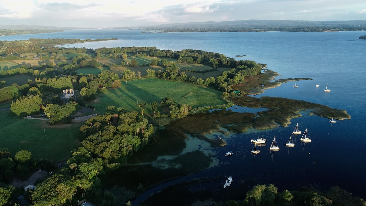
For a drone view of the fort see this picture here. It gives an idea of just how close it is to the lake. It is in the centre background.
Its sheer size and location near the lake makes it unusual and worthy of further study. The bay here at Dromineer would no doubt have always been a natural harbour.
The fact that no local knowledge or folklore has survived suggesting it was an eccesiatical site must also be unusual and there does not appear to be any evidence of buildings within the enclosure.
Edit: From ITB Report on Puckane pg 3
"At Kilteelagh on the jackson estate (1/4 ml s. of Dromineer) are the remains of a large rath - 2 acres in extent, having a circumference of 500 yds. About 140 years ago brass battle axes, coins & large human bones were found. This fort was a Danish Settlement."


No comments:
Post a Comment