Sunday, 29 March 2020

A possible burial mound rediscovered and a solution to a townland name at Townlough

The Mound from the shoreline

Two of my interests came together in the rediscovering and recording of a possible burial mound in the Castletown Arra area of Tipperary between Portroe & Ballina.

While working through deceased local historian Mikey Joy's archives I came across reference to a place known as the Sally Point in the townland of Townlough Lower. Initially I always thought of Townlough as being up in the "hills", I didn't really realise that the townland stretched all of 2kms down to the lake.

It was described as a mound where there was some folklore related to fairies interfering with workers at harvest time. With the scanning work continuing with this large archive of material I didn't think too much more about it but slowly I think I turned it over in my head.

I knew that the meaning of the name Townlough was "Tuaim an Lacha" or "Burial Mound by the Lake" and this had always bothered me, what tomb / burial mound was it referring to? I had actually wondered was it the Graves of the Leinstermen, which is just on the edge of the townland in Coolbaun but actually about 2km away from the lake.

I wondered was there anything unusual along the lake shore in the townland and thanks to aerial photos on archaeology.ie I could see that there was an unusual grove of trees that "kicked" out from the natural tree line.

Copyright OSI / NMS
I looked on the old maps and this little "kick" seems to date back till at least the 1840s and is included in all of them.

Copyright OSI / NMS
I then went through all the stuff that has been scanned as part of the Mikey Joy Archive and found a more detailed version within the archive with some more information on this mound at the Sally point.

"The Sally Point

This mound is known locally as The Fairy Clump and is situated at The Sally Point, Townlough Lower.  

Iniscealtra or Holy Island is approximately 3 1/2 miles away in Scariff Bay. In the 9th and 10th centuries the monastery there was the target of several attacks by the Norsemen. The monks built a round tower for protection and it is at this point we enter the realm of folklore. The story is that, as well as the round tower, the monks also built an underground passage all of 3 1/2 miles long with an exit at this point. It sounds incredible, but old residents of the area would tell you that in the early years of the century the site was explored by an archaeologist, who was rewarded for his efforts by finding the exit of the tunnel. He entered the passage, but after proceeding a considerable distance, his lighted candle failed indicating lack of oxygen, so he had to abandon his mission and return to the daylight.


Other stories from this locality concern the activities of the 'good people' especially around the mound at the eerie hour of midnight. In the last century this land was farmed as part of Derrycastle. This particular field was usually a meadow and mown at the time with scythes. In hot weather the men would work in the early morning and again late in the evening, sometimes continuing until one or two o'clock with moonlight. On one particular midnight they edged their scythes beside the Fairy Mound, but when they went to mow, the grass was lying and they couldn't cut it.  

In this case the men decided they weren't welcome and went home for a few hours sleep. When they came back in the morning the hay was standing, the edge had returned to their scythes and they were able to continue their work unhindered".

What seemed particular persuasive was the mention of a "tunnel" in the mound. Now of course it isn't possible that is went all the way under the lake to Holy Island but often mounds with passages or cists within have folklore like this.

Finally I got a chance between everything to head over that way by fishing boat (weather and life in general) and amazingly my hunch was correct. There was a mound at this location (see picture above).

Is is a definitely a burial mound? That will be difficult to ascertain for sure. In the townland there are also the remains of a towerhouse linked to the Rollestons and the field boundaries could suggest that there was formerly some kind of estate gardens here. Could this mound be some kind of garden feature, a tree ring perhaps? I don't think so.

I sent on the information I have to the National Monuments Service and it has since been added to the Sites and Monuments Record. The local archaeologist has not inspected it yet, only the information I was able to put together.

However I would argue that the case is strong for the discovery of Tuaim an Lacha or the Burial Mound by the Lake. A burial mound that gives its name to an entire townland must have been of importance.

Anyway I'm posting this to see if there is anymore information about the mound, for or against.

Friday, 13 March 2020

The Danes Bed - Baurnaglanna / Lackabrack


Copyright - OSI
I was looking back over some notes I took about possible archaeological features mentioned in the Irish Schools Manuscripts.

One was a Danes bed in Lackabrack near the Silvermines."There is a Danes bed in one of Kennedy's fields in Lackabrack. A Dane was coming home from selling eggs. She was asked to take the shortest road she could so she jumped into Kennedy's field and she broke her leg in the fall. She died in that spot and was buried there. That is called her bed where she was buried. The previous owners of the field "Coghlans" ploughed around it and immediately they all got sick. The bed consists of two stones at the sides, one at the head and one at the foot."

I wonder could this be a description for the megalithic structure that is just on the townland boundary between Baurnaglanna / Lackabrack. It is described on archaeology.ie as follows

"There is no recognisable ancient feature at the position indicated on the OS 6-inch map which is on the E side of a field-bank at the foot of a S-facing slope just N of the Mulkear River. An OS Name Book (c.1840) records that the name applied to a 'a heap of stones covering about a square perch [c.5 m?] of ground'. An account in a later OS Name Book (1904) claims that the feature in question was a horizontally laid stone. Crawford (1910, 41) noted a large stone buried in a field bank a projecting corner of which rested on a smaller stone. The nature of the feature referred to is uncertain. (De Valera and Ó Nualláin 1982, 97-8, No.5)"

Borlase gives a description as follows

"Borlase, No. 1 (under name of Knockanroe). This is a doubtful specimen, and situated in an unusual place, that is in the side of a glen or ravine. A large flat stone is buried in the bank, with one corner projecting, and this corner rests on a smaller stone ; nothing more can be seen. Bauraglanna is in the valley called Glenculloo, at the foot of the Keeper Mountain, a mile or more south of the village of Silver mines".


I'd say there is a very good chance they are the same.

https://www.duchas.ie/en/cbes/4922152/4856580


Sunday, 1 March 2020

Mauherslieve Mountain - An unrecorded Passage Tomb in Tipperary?


It is 16 years since I last climbed the Mauherslieve Mountain and I'm well overdue a return visit. On top is a large cairn which is likely to be a passage tomb, making it only the 2nd passage tomb in Tipperary.

From archaeology.ie

"Described in the OS Name Books (1840) as a large heap of whitish stones on the summit.. Under which it is said there is a cave or cellar in which a great number of the neighouring people took refuge in the time of the rebellion... it is not known when this cave was made in the moutain... the entrance to it cannot be seen as it is covered with the large stone above mentioned". 


The exact meaning of the word Mauher Slieve Mountain is not definite. It is sometimes translated as the Mother Mountain but I'm not 100% sure if this is accurate. The local pronounciation of it is different to the how "Mau her" is pronounced in Irish.

If we see Tempan's paper linked below (Two Moumtain Names, Slieve Felim and Mauherslieve) he records the pronounciation as "moherclea" and "moher" (see pg 123) which tallies a lot more with how I heard it myself locally in 2018 at Kennedys Bar in Rearcross.

He thinks the true meaning / name of the mountain may be "Mothar Shléibhe or Mothar an tSléibhe, 'overgrown wilderness of the mountain".

For more on the meaning see here from the North Munster Antiquarian Journal (2006).

In it he mentions Speed's 1610 map of Munster and the name "Ghe Madona" which he has been unable to identify and I do wonder is it related to Mauher Cle, one of the names given to the mountain. Could the Madona refer to Mother and Geh to Cle?


It was one of the Twelve Mountains of Ebhleen or "Phelem" as incorrectly named in Speed's 1610 map above.

From Sacred Ireland by Cary Meehan

"Ebhleen was a mytholocial figure, married to a king of Cashel. She fell in love with her stepson and eloped with him. 
Right in the heart of these mountains is a small peak called Mathair Shliabh or Mother Mountain which has a cairn of stones on top called 'the Terrot'. Those climbing the mountain would carry a stone from the bottom to add to this cairn. The cairn was said to cover the grave of a young man who refused to go to mass one Sunday and went hunting instead. Although it was June - June 29th to be exact - he was caught in a snow-storm and his body later found at the spot now marked by the Terrot.
There was a traditional outing up the mountain here unitl the 1920s. It involved the usual Lughnasa activities of berry-picking, singing and dancing, though the date was 29th June. The monks of Kilcommon were to have started it but it is more likely that they changed the date from Lughnasa to the earlier date which is the Feast of SS Peter and Paul (The Festival of Lughnasa)".

There is more on the Twelve Mountains of Ebhleen in Tempan's paper (pg 120) and it is also the location in the Lebor Gabála Erenn of the place where "the newly arrived Milesians meet with the Goddess Fódla, who appeals to Amergin, leader of the invaders to name the country after her". 


Some really interesting folklore on an event that occurred on the mountain.

"On the 3rd April 1931 a funeral was seen crossin the side of a high hill called Moher Cle, situated in the parish of Templederry about ten miles from Nenagh. That same evening Mrs. Burke of Coumnagella was dead. The funeral which consisted of white horses & common cars commenced in Coumnagella and after passing over the side of Moher Cle disappeared at Bray's Lough. There were about 50 cars all together and in some cases the drivers of the could be seen whipping the horses. The evening was clear & bright & the time about 7 o'clock." 

I did wonder about this story and something called Charles Bonnet Syndrome. I'm not convinced really whether by giving it a name does it really explain it away but the whole thing is fascinating.

This is only the tip of the iceberg regarding this mountain, it is surrounded by megalithic tombs, of which I have written on here before. It could be argued that this mountain is a ritual "focus" of the tombs that flank it in what may have been a very well populated area when the tombs were being constructed or the area was thought of as sacred enough to justify the large amount of work that went into constructing them.

Collasped section within the cairn.

Saturday, 22 February 2020

Miler McGrath

"Here where I aim laid, I am not
Nor am I in both places, but I am in each
It is the Lord who judges me.
Let him who stands take care lest he fall"

The table top tomb of Miler McGrath lies within the walls of Cashel Cathedral at the Rock of Cashel.

For more on this controversial figure who was both a Catholic and Protestant Bishop and died at the age of 100 with nine children, see Seamus Kings brilliant lecture below.

https://www.seamusjking.com/sjk-articles/2017/3/7/miler-mcgrath-1522-1622-talk-given-to-cashel-historical-society-circa-1986

Saturday, 15 February 2020

Danes in Tipperary / Arra

Copyright - University of Wisconsion / Milwaukee 
The above is an extract from a map located here.

I have written about a similar map that Rev. John Gleeson used in both The History of Ely O'Carroll Territory and also Cashel of the Kings. It looks to me as if this map was the basis of both.

Those maps located "Danes" in what is now the half-barony of Arra or probably better known as the Burgess / Portroe / Ballina area in County Tipperary.

I have written about this map here & about possible Viking settlements on Lough Derg here.

Since Rev. Gleeson's extracts only covered the Tipperary area and seemed to only include prominent surname / clans in that area, it could have been possible that the "Danes" referred to the surname Dane or Dean even if that was not a well known name in that area. The 1901 and 1911 census actually record few of either name in the entire country at that time.

However this new map covers the whole of Ireland and if you see the extract above it also locates Danes at Limerick.
Other places on the larger map where it locates Danes includes Wexford, Waterford, Cork, Athlone, Lough Neagh, Belfast Lough, Strangford Lough, Dublin and Wicklow.

So I think this conclusively shows that it is referring to Danes or Vikings rather than a surname. I know that Brian Boru and his descendents based at Kincora would have been in close contact with the Danes but this location in Arra seems to be far enough way that isn't just a mistake for this location or a mapping error due to not having enough room to place it elsewhere.

I have yet to come across any primary references to Danes locating in this area although Gleeson does say the following

"The tribe land of O'Sextons lay along the coast of Lough Derg in the Shannon between Dromineer and Castlelough; it was contiquous to the tribe land of the O'Glissane (Gleeson), whose land lay between Castlelough and Killaloe on the Tipperary side of the lake. The Danes settled in the neighbourhood of the O'Sextons, which may explain the fact that the name is now extinct in North Tipperary, but is found in West Clare". 
From "The history of Ely O'Carroll Territory" by Rev. John Gleeson. Pg 52/53

On a local level I have come across a field name in the Castletown area known as The Danes 'Deans" but I don't have an extact location. That looks to be the next step in this research.

Sunday, 2 February 2020

The Tara Prince, the Egyptian Princess and other alleged links between Ireland and Egypt in ancient times


I think most of us have heard the stories that originate in the Lebor Gabala Erenn linking Scota or Scotia with Ireland.
https://en.wikipedia.org/wiki/Scota

It is a great story but the problem is when it used as fact.

I few years back I first heard of the claim relating to the Tara Prince and the faience beads that are claimed to originate in Egypt.

"The Tara Prince" aka Tara Boy

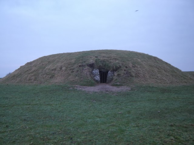
An excavation of the Mound of the Hostages in 1955 by Sean O'Riordain uncovered a number of items within the mound (which turned out to be a passage tomb). One was a set of faience beads now on display in the National Museum of Ireland.
They were associated with a skeleton that in pseudoarchaeology has been dubbed "The Tara Prince".

Copyright National Museum of Ireland

When I read about the claim linking him back to Egypt curiosity got to the better of me and I had to see if there was any basis in it. You can see where the claim arose in O'Riordain's paper "A Burial with Faience Beads at Tara" from 1956
https://doi.org/10.1017/S0079497X00017539

O'Riordain (pg 170) states:

"The faience beads have been submitted for examination to Dr J. F. S. Stone, who has kindly supplied the following report; 
'The four greenish-blue to blue faience beads from the Mound of the Hostages, Tara, are of considerable interest in view of their extreme rarity in Ireland in comparison with England. Only two other instances are known to me ; one of four segments from Dundrum Sandhills, Co. Down {Archaeologia, LXXXV, 1936, 251), and another of two segments found with a cremation at Ballyduff, Co. Wexford, sent to me by Mr P. J. Hartnett in 1952. ' The Tara beads are not made of true faience, which normally has an external coloured glaze, but of a well-known variety of the Eastern Mediterranean synthetic material in which powdered blue glass or glaze has been mixed with quartz grains and which, after moulding, has been fired. Such hard glassy faience, or variant E of the material, as has been described by A. Lucas (Ancient Egyptian Materials and Industries, 1948, 188), is well-known in Egypt, and has been found in the British Isles. It consists mainly of quartz grains which appear to be floating in a lake of glass, and numerous air bubbles are often present in the fabric. In the case of the Tara beads, the quartz grains are relatively large as compared with the finely powdered quartz used in the manufacture of the similar glassy faience Ballyduff specimen, and the fabric is somewhat porous. They compare very closely with the slightly smaller but similarly made necklace of six glassy faience beads found in 1938 with a cremation and plain food vessel at Long Ash Lane, Frampton, Dorset, and now in the Dorchester Museum (Antiquaries Journal, 31 (1951), 30). They compare favourably too in the large number of segments present, the maximum at Tara being 11, that from Frampton being 15. ' Although not quite so finely made as the Wiltshire examples of true faience, they nevertheless belong to the same variety having large perforations ; and though recalling the glassy faience fabric of some of the Scottish specimens they do not resemble them in having " crimped segments ". ' In the absence of any known evidence for local manufacture of this complex material in the early primitive societies of Europe, and in comparison with known examples in the British Isles, I would infer the burial to be of the Wessex Culture period and would date the beads c. 1400 B.C. by comparison with similar examples from Abydos, Egypt, and Tell Duweir in Palestine, both of that date. However, we cannot entirely exclude a possible Syrian origin, the fourth literate civilization known to have exploited the industry, and it would be wiser to refer to them as of Eastern Mediterranean origin. It remains for the future to prove the ultimate source. One thing is certain at present; spectographic analysis, or other forms of chemical analysis, would yield no results of value. Until some means is found to distinguish between powdered quartz from different sources, we must rely entirely on the morphological characters of the objects themselves.' J. F. S. STONE, 25-11-55. 

(My bolding above).

I'm not sure how Stone here can on the one hand state that "I would infer the burial to be of the Wessex Culture period" ie Wessex in England and then refer to them as of Eastern Mediterranean origin.

Later in the paper O'Riordain (pg 173) concludes similarly but again ignores Stones point relating to the Wessex culture:
"There are various possibilities as to place of manufacture, an Egyptian source being still preferred. There is also a spread of dating because of early and late associations. It appears in the present state of knowledge safe to refer to an Eastern Mediterranean origin (as does Dr Stone) and to accept the 14th century B.C. as the most likely date for these segmented beads.
However like all sciences conclusions change once more evidence becomes available." 

This is not an area that I am an expert in but I don't see how the conclusion fits the evidence here. The more likely conclusion being that the idea / method of manufacture travelled to Northern Europe rather the beads themselves.

In pseudoarchaeology the possible Eastern Mediterranean / Egyptian origin has been built upon that the person who was buried at Tara had to have brought the beads on his person with him from the Eastern Mediterranean / Egypt. When I read this I thought the far more likely possibility was that either the beads were traded via trade routes to Ireland or that the method of manufacture similarly followed these trade routes and they were manufactured locally.

More recent research and evidence has shown this to be the more likely conclusion.

A paper written by Alison Sheridan et al has this to say

The burial was redated with more advanced methods to
"Alex Bayliss for the present publication and the symposium that gave rise to it, has concluded that ‘Tara Boy’ is most likely to have been buried between 1700 and 1600 cal. BC (at 68.2% probability according to her model 14; cf. the 95.4% probability range of 1740–1535 cal. BC"

About the faience beads and their origins it states
"Faience beads are known from several find-spots in Ireland, with a strong easterly bias (Fig. 7, and see Williams et al. 1991–2, fig. 6). Overall, around 32 beads (including seventeen of segmented form) from sixteen find-spots are known, with the earliest example being a two-segment bead associated with cremated remains and a Vase Food Vessel from Ballyduff, Co. Wexford. The Ballyduff bones have been dated to 3550±50 BP (GrA14604, 2030–1750 cal. BC: Brindley 2007, 93). Brindley (2007, 313–15) has argued for two episodes of faience use in Ireland, with Ballyduff belonging to the first and dating from c. 1920–1800 BC, and the Tara beads belonging to a second—mostly associated with the use of Cordoned Urns—between c. 1720 and c. 1520 BC. Whether there had actually been two episodes is debatable, but the key observation to be made about the Tara beads is that, as with the other beads in the necklace, there is a strong link with contemporary practice in Wessex, where around half of all the 365+ Early Bronze Age faience beads from Britain and Ireland have been found, and an even higher percentage of the beads of segmented form (Sheridan and Shortland 2004,
figs. 21.4 and 21.7). There are grounds, however, for claiming that the Tara beads had not been made in Wessex but were probably made locally. The first of these is the fact that the segmentation has been effected by scoring rather than by the method used in Wessex, where a tube of faience was rolled against a former, like a butter pat in shape, to create segments and grooves of regular shape and depth (ibid., fig. 21.6). The second is that, unlike many of the Wessex beads, the Tara ones do not contain high levels of tin; and the possibility that arsenical copper had been used as a glaze colourant also sets them apart from British beads. It is therefore likely that the faience beads were made and added to the necklace in Ireland, but arguably as a way of enhancing the similarities with the composite necklaces that were fashionable in contemporary Wessex."
This is supported by the place of origin for the rest of the finds in the paper and can be read below. 

about O'Riordains conclusion the paper states

"It should be added that Ó Ríordáin’s (1955, 173) claim that the beads had been imported from the eastern Mediterranean around 1400 BC can safely be discounted, given our present understanding of the dating and spread of faience use (Sheridan and Shortland 2004)."

https://www.academia.edu/7798892/Tara_Boy_local_hero_or_international_man_of_mystery

Newton & Renfrew also looked at the spectrographic analysis carried out by the above Stone and also Thomas in their paper "British Faience Beads Reconsidered" (1970).

They say (pg 199)
"When Stone and Thomas considered the subject in great detail in their important and valuable paper ‘it was confidently expected, in view of earlier work, that clear trends in the composition of faience beads would be found which could be correlated with both source and date of manufacture’ (1956, 75). The hope was that spectrographic analyses of the British beads would allow a division into groups corre- lating with analysis of Egyptian and Mycenaean beads. In this way both a source and a date of manufacture might be ascribed to the British finds. This hope was not fulfilled and they were ‘therefore, somewhat reluctantly forced to the conclusion that the spectrographic technique does not confirm the promise of earlier in- vestigations’" 

They reexamined the finding and found that (pg 201)

"the Scottish beads contained greater quantities of the elements examined than did the Wessex beads, and those contained more than did the Egyptian beads""

It goes through various elements that are present in one but not in another for example (pg 201)

"Here we are mainly concerned with the differences between the Scottish and the Wessex beads, and all of these contain some tin (except Wessex bead No. 7 which does however contain tin in Table IV) and it is convenient to plot the Mg/Sn ratio against Al, as is shown in FIG. I. All the Scottish beads have a Mg/Sn ratio of 1-0 or more, whereas the beads found in England generally have ratios of less than 1.0, and the beads from the two geographical groups thus fall into two areas on the diagram which meet at the point Mg/Sn = 1.0; A1 = 4. Many of the Mediterranean beads contain no tin, and they have therefore been ignored in this visual presentation; only five of the Egyptian beads fall in either of these two areas of the diagram, and there is thus clear initial support for an hypothesis that the British beads did not come from Mediterranean sources. It is even easier to discriminate between the Scottish beads and any Mediterranean ones by adding the values (after transposition to our scale) for Mg + A1 + Sn + Ti, because none of the twelve Scottish samples (11 faience and I slag) has a value less than 10 (average = 12.7) and none of the 40 samples from any other region (except England) has a value larger than 9 (average = 6.8). The hypothesis thus gains support when titanium is added to the picture." 


It looks at the archaeological implications and states (pg 202)

"This separation of the Scottish, English and Mediterranean beads into groups, established above, does not of itself prove the local manufacture of the beads. But while the theory that all the beads were imported from the Mediterranean could still be upheld, it would require some very special pleading. Such pleading might be possible were there abundant evidence of Mycenaean or Egyptian influence on Bronze Age Britain, or even of evidence that beads with these compositions are to be found in the Mediterranean area." 

Scotia the Egyptian Princess

Scota and Gaythelos Scotichronicon, Corpus Christi College, Cambridge.  Image Wiki.
I'm no Egyptologist but I do know one and that is Andrea Sinclair. She has written a piece of the possibility of there being an Egyptian Princess named Scotia.

The main conclusion is as follows:

Egyptian Princesses were divine and were never married off to foreigners.

"But did you keep the word 'princess` in the back of your mind while reading this?  

Because what is essential to these romantic concoctions, is the misleading use of the word  to describe these women, which immediately delegates them to inferior status in the reader’s mind.  You know, as unmarried young women in a 19th century oil painting languishing around a palace on pillows shaking a sistrum, eating dates and waiting for a prince, only useful as tools for forming canny political alliances.

The ancient Egyptians simply did not work that way.


Egyptian princesses were considerably more important than that, queens even more so, they all held roles of high ritual importance. Try inserting queen of Egypt into every context where princess is used to sell this tosh and see how that changes the tone a lot.... great queen Meritaten - great queen Ankhesenamen.

Neither woman was an object to be fobbed off as reward for military prowess on some stranger from Scythia or Greece or even Tyre.  Meritaten and Ankhesenamen were chief queens and one of them was quite likely king of Egypt between 1335-1332 BCE.   

The only way you actually quit those jobs in Egypt was by dying. 

When a king died, if living, his chief wife became the dowager queen, a role as ritually important as chief queen.  You were responsible for running the country if the heir was underage, a semi-divine entity, a conduit for the goddesses, Hathor's earthly representative.  You couldn’t just run off to Spain with some guy in your dad’s army, a vassal governor, or your grandfather (urk)."
You can read about the flawed chronology and the flawed archaeology here.

https://artisticlicenseorwhyitrustnoone.blogspot.com/2019/09/scota-egyptian-princess-who-wasnt_24.html

The Barbary Ape

Barbary ape skull from Navan Fort (after Lynn 2003, p. 49) / irisharchaeology.ie

Sometimes the Barbary Ape found at Navan Fort is added into the mix. The ape skull has been dated to 390-320 BC.

http://irisharchaeology.ie/2014/05/a-barbary-ape-skull-from-navan-fort-co-armagh/

Edit: 

Another interesting part of the story is that of Scotia's Grave south of Tralee. 
The townland name it located in is Glanaskagheen or Gleann Scoithín. https://www.logainm.ie/en/1414581?s=Gleann+Scoith%c3%adn#

Rather than Scotia's Glen this actually translates as Glen of Wispy Flax or something similar. "Scoithín: A little wisp of hemp or flax ; a small lock of hair. (Dineen - Foclóir GB - 1904). (Thanks to Jim Hynes of the facebook group Irish Placename Research for that). 

For more on a visit I took to Scotia's Glen see here. Sadly there was no evidence for the hieroglyphics that are sometimes said to be carved there!  

Saturday, 18 January 2020

Hugh O'Donnell and his daring march in the Slieve Felims

Copyright www.duchas.ie used under CC-BY-NC 4.0 https://www.duchas.ie/en/cbes/4922083/4850640

"O'Donnell's army marched through Roscommon and Galway, reaching Cashel by 18 November. Mountjoy ordered Carew north to counter the Irish advance, but on 21 November O'Donnell sidestepped Carew's blocking force. Described as 'the greatest march that hath been heard of at this time of year', O'Donnell stole a night march on the lord president, crossing over the frozen Slieve Phelim Mountains." from pg 163 of "The Nine Years War 1593 - 1603" by James O'Neill. 

It is interesting how small events on a national scale, leave large imprints on a local scale. The daring night march that O'Donnell stole through the Slieve Felims in 1601 was still remembered in the schools folklore manuscripts of the 1930s featuring in Foilycleary and Kilcommon schools.  The teacher in Foilycleary (Ml. O Heachthigheirn) even drew a map of the likely route . If I recall there is a plaque in the area commemorating it as well.

https://www.duchas.ie/en/cbes/4922083/4850649

"When Red Hugh O'Donnell was camped at Holy Cross on his way to Kinsale in November 1601 to assist the Spaniards, he found himself surrounded by the forces of Carew and Mountjoy. A very great frost came on the night of the 13th of November and impassible bogs to the Slieve Felims became frozen hard. I know the country very well between Holy Cross and Croom, and I know the only great bog on the way is Cummer bog (shown on map at page 5).
There are other smaller bogs but none as large as Cummer. When these bogs became frozen hard that night it was possible for Red Hugh and his army to strike their camp and march away from their enemies. They did so, and in that very famous march they covered about 40 statute miles and camped at Croom next day. They must have followed (at least roughly) the line where is now the Anglesea Line as far as Réidh." 

https://www.duchas.ie/en/cbes/4922143/4856167/5015381

"When Hugh O'Donnell was proceeding to the Battle of Kinsale in 1599, his march was interupted at Loghbrack, because he could not cross the bogs with his heavy artillery. The bogs were too soft. That night it froze very heavily and early next morning Hugh crossed the frozen bogs safely & proceeded to Kinsale. Logbrach is about 2 miles south of Kilcommon."

https://www.irishtimes.com/news/in-quest-of-living-legends-1.328625

From the Irish Times 
"In the winter of 1601, Red Hugh O'Donnell's forces were confronted by an English army in Co Tipperary as they marched south to Kinsale. O'Donnell's men tramped 40 miles non-stop under cover of darkness across the frozen bogs of the Slieve Felim mountains to escape. A seasoned opponent on the English side, Sir George Carew described this without a grudge as "the greatest night-march in military history". Not only were the iron frosts of a mini-ice age on their side, but O'Donnell's men were bred for distance."


So we can see just now impressive this feat was. There was no road through this area until the 1800s when the Anglesey line was built through the area. I was reminded of reading this event a few years back by the recent Art O'Neill challenge (happening this weekend) which commenorates the escape by Art O'Neill, Henry O'Neill & Red Hugh O'Donnell in 1592 from Dublin Castle in the middle of winter when they treked to Glenmalure in Co. Wicklow.

https://www.historyireland.com/volume-23/the-art-oneill-challenge/

Perhaps Red Hugh learned something about travelling through frozen hills from this event but I'd imagine there were plenty of frozen nights up in Donegal for him too!

Edit

It was great to find a continuation of this folklore recorded near Croom in Co. Limerick between Croom and Manister in relation to a road known as "Bothar Ultach" or Road of the Ulstermen.

Milo Spillane writes about it in the North Munster Antiquarian Journal (2014, 156)

"However, help was at hand in a most unexpected and fortuitous manner. A frost of extraordinary severity set in during the night, which made firm ground of the impassable swamps. When told of this O'Donnell roused his sleeping forces and hastily set out, and under cover of darkness, travelled over the frozen bogs and through mountain valleys until they reached ground at Abington, County Limerick.... The bedraggled army reached the safety of Croom that day without any further interference or hindrance having travelled along what then became known as Bothar na nUltach"

http://www.limerickcity.ie/.../15%20bothar%20na%20nultach...

Looking at Google Maps - a March from Holycross to Croom is circa 40 miles / 60kms via the mountains. Doing that on a frozen night in November was some achievement and surely would be one of the great Irish legends if not for the disaster at Kinsale.


1766 Census for Abington

1766 Census for Abington, Co. Limerick.xlsx